Blog Image

travels with janne

5 – Ships, worship and Denmark’s birth certificate

Denmark Posted on 12 Oct, 2016 20:38

The next part of the hike I walk alone for two days, totaling
about 54 km. I start where Niels and I left off last time at the lake Fårup Sø
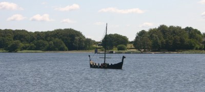
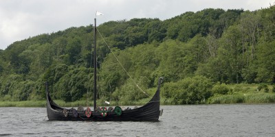
on the southern outskirts of Jelling. A reconstructed Viking ship floats in the
water and reminds visitors that they have now arrived at the ancient Viking
stronghold.
Jelling is where pagan Viking gods meet Christianity
and where the first king of Denmark was buried. It is considered Denmark’s
birth certificate. This marks where the Danish monarchy and Christianity in
Denmark began. The area is so full of history that it has been designated a
UNESCO World Heritage Site.
Let’s start with the burial mounds. The biggest of
them is the largest burial mound in Denmark and was constructed on top of a
burial mound from the Bronze Age. Two million turf blocks were used to build
it. The other, smaller, burial mound is where Denmark’s first king, Gorm the
Old, was originally buried as a heathen in the year 959. A few years later, his
son Harald Bluetooth moved his father’s remains to give him a Christian burial.
There are remains of a grave chamber that lay in connection with the original wooden
church. Now there is a stone church – back to that later.

Outside the present church are two rune stones. The
smallest of them was raised by King Gorm the Old in honour of his wife Thyra.
It mentions the name Denmark for the first time. The largest of the stones,
from the year 965, was raised by Harald Bluetooth in honour of his parents, Gorm and Thyra. It
says that Harald won all Denmark and Norway and made the Danes Christian. This
marks the point in time when the Vikings downsized from having many gods (such
as Thor and Odin) to having just one.
The stone also has Scandinavia’s oldest picture of
Christ. The same picture adorns the Danish passport. Whether we are religious
or not, we cannot escape the fact that Christianity is an integral part of our
Danish heritage.

So much for the burial mounds and the rune stones. The
area also encompasses an enormous stone ship (350 m).

Originally, it encircled
the spot where Gorm the Old was buried. The ship ensured that he could sail to
the gods in mythical Valhalla (Valhalla was Odin’s home and where Vikings that
died honourably in battle went to).

Surrounding the two burial mounds and the
stone ship was a 1.4-km long and 4-metre high palisade. It surrounded an area
corresponding to 12 soccer fields (12 hectares). The palisades are now marked with white stones. The size and grandeur of the
whole shebang attest to Gorm the Old’s power.

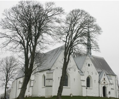
Lastly, there is the church. It is one of Denmark’s
very first stone churches, built around 1100. It lies where the original wooden
church built by Harald Bluetooth lay. Although the church is old, not much of
the interior remains from that time It is in fact quite modern with typical
understated, elegant Danish design. A
silver stripe in the floor indicates where Gorm the Old was re-buried.

A replica of a sailing ship hangs from the ceiling.
Numerous queries on my part and hunting around on Google have not given me a
satisfactory reason for the Danish tradition of hanging ships in churches –
just many suppositions. Nevertheless, it is a nice habit.

Well, folks that was your history lesson for today. I
think it is fascinating to experience hundreds and hundreds of years of history
merely by following a path up through Jutland.


4 – Pagan history in a pastoral landscape

Denmark Posted on 09 Oct, 2016 14:25

In the first summer months of 2016, I resume my
project of walking all the way up through Jutland.

Once again, I have my friend Niels for company. Last year we ended in the southern
part of Jutland, just north of where the old border to Germany used to be.

We left off in Læborg, at a white church in front of
which was a big stone with runes engraved on it. This year we start in Bække, five
kilometres north of that church, at another white church with a big stone with
runes on it. This stone is from about 925 AD and is yet another reminder that
this historical route has been used since the days of the Vikings.

Runes and rocks, stone and ships

On our journey northwards we come upon an even more
ancient monument at a place called Klebæk Høje. This spot is 81 metres above
sea level so it has afforded good views of the surrounding area throughout the
ages.

On this spot there are two burial mounds dating back
to the Bronze Age (3,500 years ago). Later on, about 1,100 years ago, an
important Viking woman was buried here. She was honoured with a stone ship.
This was a custom in which the burial or cremation area was surrounded by stone
slabs that formed the shape of a ship. Historians figure that these ships were
constructed to provide the dead person with means of transport to the next
world. This particular stone ship is 45 m long. One of the Bronze Age burial
mounds is at the helm of the ship while a big stone with runes engraved on it marks
the other end of the stone ship.

The historical Hærvejen – the road that we are
following up though Jutland – cuts right through the ship, leaving a 10 m wide swathe
that has worn down into the ground.

Not far from the stone ship we come upon another
interesting rock – the Hamborggårdstenen. This 50 ton boulder was transported
at the front edge of a glacier during the Ice Age and left behind when the
glacier receded. It came from Ålandsøerne, which is a group of Finnish islands
snuggled between Finland and Sweden. The glacier pushed the block of stone for
hundreds of kilometres about 20,000 to 25,000 years ago. Neat, eh?

Then along came the Viking Harald Bluetooth (not the man in the photo – that’s Niels). He wanted
to drag the boulder to his mother’s grave in Jelling (you will hear more about
Jelling later on). I don’t know if he would have succeeded, but he abandoned
the project when he learned that his son Svend Forkbeard was plotting to depose
him as king.

I’ll get back to Harald Bluetooth and his parents
later on, when I reach Jelling. In the meantime, Niels and I wander through the
attractive Danish summer landscape.
I think it is best at this time of year,
i.e. late spring and early summer. Along the way, we see idyllic country homes
with thatched rooves. We see deer and hares, cattle and cows, free-range pigs, vineyards, and fields with barley, rapeseed, wheat and rye before reaching the southern outskirts of the town of Jelling.


Local adventures

Denmark Posted on 30 May, 2016 20:16

I have
written about my travels in various exotic places but I also have adventures
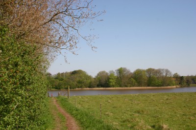
closer to home. All I have to do is step out the door and start walking. Five
minutes later, I am on a path that leads me around Vandkraftsøen (literally ‘Water
power lake’).

The first
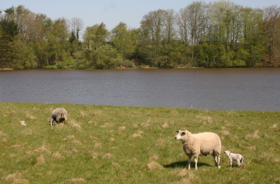
part of the walk leads me through a grassy field, which is where I take my
daily walks. At this time of year sheep and lambs abound. The lambs are
unabashedly cute. They are presently at the age at which they are discovering
friendships in each other. They romp, frolic and dash about while their docile
but watchful mothers graze.

Fifteen
more minutes of walking brings me to a small wood. The forest floor is white
with anemones (some of whom are sisters to the ones I have in my garden…) I
hear woodpeckers, chaffinches and warblers and, in the distance, kayakers and
canoeists on the lake. I get occasional
views of the lake on my left. A swan sits on her nest and stretches her neck to
pull in grasses and reeds and other building materials to add extra comfort for
the coming cygnets.

I pass by a
lovely, placid pond and pause to enjoy the stillness, so close to home yet lost
in my own little world for a spell.

The path is
steep and narrow at times, which I suppose is one of the reasons that it is not
overrun by crowds of people, even on such a fine day as this. I find more
anemones, including sunshine-y bright yellow ones.

Interesting
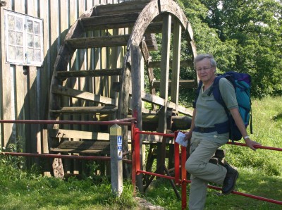
landmarks on the route are the little watermill (Tvis Mølle) and adjacent monastery
ruins (Tvis Kloster). I drive past these two historic sights every day on my
way to work. The watermill was reconstructed from the one that was built in the
1700’s but records show that there has been a watermill here since around the
late 12th century. It was owned by the Cisterciensian monastery Tvis
Kloster, which was established in 1163. The monastery fell into ruin and was
eventually removed but there are still remnants of it: the peaceful graveyard,
a few foundations, and stones in the modern paved road showing where the
monastery lay. The monastery was actually on a small island, snuggled between
two tributaries of Storåen. Denmark is filled with so much history –
fascinating!

As I walk
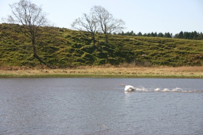
on the bridge to get to the other side of the lake, a swan gets it into its
head to skip like a stone along the water. Startled, I fumble with my camera to
catch a shot of the bird in mid-flight. However, the swan never rises above the
lake’s surface to fly but eventually settles down and starts grooming its
feathers.

The path
now follows the bicycle path I take when I visit my mother in her old age home
(if, lazy me, I don’t take the car instead). A few huge buildings sit on the
top of the hill with, I would guess, amazing views of the lake. They look like
office buildings but are actually private homes. Square boxes are the latest
architectural rage in Denmark for offices and private homes alike.

Shortly
thereafter are more sheep, lambs, peace and quiet. I pass very close by the
table and benches that I would bring my mother out to so we could enjoy a view
of the lake together. Now it is too far for her to walk, unfortunately.

I then walk
through a verdant cathedral. There are anemones on the forest floor and a light
green canopy formed by the newly unfurled leaves of the beech trees. Spring in
Denmark is a thing to behold! Who needs churches when you can rejoice in
nature? Nature can be harsh, though, as I am reminded when I spot a turquoise
egg that has fallen out if its nest. That broken egg will never become a bird.

The last
leg of the walk is more urban than the first part. I pass by the regional
television station TV MidtVest that must certainly be the place of employment
in Holstebro with the best view.

Next up is
the dam where the water rushes through with mighty force. Vandkraftsøen is an
artificial lake that was created to harness hydroelectric power from the river
that flows through Holstebro (Storåen, literally ‘The Big River’).

Then there
is the building that used to house the restaurant ‘Søens perle” (Pearl of the
Lake), where Johannes and I had our wedding reception on 7 June, 1986. A horse
and buggy drove us up right on the lawn while the guests awaited our arrival.
Those were the days. Now the building houses trade union offices. How
unromantic.

Back to
nature for a while again. There is a stream with water that is coloured brown from
ochre. The ochre in the water in our area is also what makes it hard to keep
white laundry white. Welcome to the land of grey bras and panties!

After two
hours of walking (eight kilometres) I wend my way down the streets of Mejdal,
the village where I live just outside of Holstebro, until I am home again and
back to my lush and somewhat wild garden.


3 Crossing a historical border

Denmark Posted on 05 Jan, 2016 18:06

Now it is July 2015 and I am hiking the third stage
with my friend Niels. This part of the route is rife with nationalistic
emotions because the Danish-German border has been shifted up and down a few
times.

We begin where I left off last time at Stursbøl
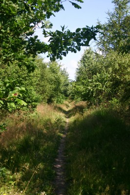
Plantage, a pleasant, wooded area. We follow a narrow dirt path and enjoy the
stillness, birdsong and whisper of wind. We pass by meadows and fields, and
cross brooks and streams. After a while, we come to the edge of the town of
Jels where the lake Jels Sø lies. This is where Viking dramas are enacted every
summer. They take place outdoors and often include the lake as part of the scene.
As Niels and I rest on a bench a Viking ship floats silently on the water.

Later on, we arrive at the idyllic old mill,
Knagmølle. This mill was used to grind bones from dead animals. The meal was
then fed to pigs and chickens. Knagmøllen is situated by the historic river
Kongeåen.

This is an area that can stir Danish nationalistic feelings. Prior to
1864 Denmark stretched all the way down to Schleswig, which is now German.
Disagreements turned into a full-blown war, which ended in 1864 with a resounding
victory to the Germans. The result was that Denmark lost not only soldiers on
the battlefield but a good portion of its area and the Danish-German border was
moved north up to Kongeåen.

Then World War I happened, which did not go well for
Germany. This gave the opportunity for Denmark to regain some of its lost land.
In 1920, two years after the end of World War I, the people in the area had a
referendum that voted much of the former land back into Denmark. The border was
thus moved south again without so much as one shot being fired – although not
all the way back to the former days of glory when Schleswig was part of Denmark.

Niels and I stay the night at a herberg (hostel) by
the historic river Kongeåen. We have all 24 beds, two bathrooms, two showers
and large kitchen to ourselves, so we spread out and make ourselves at home. We
eat a heated up frozen dinner and drink a couple of glasses of wine. Then it is
time to rest our weary bones after having walked 22 km.

Next morning we are a bit tired but not seriously so.
Today we only have to cover 15 km. The first step of our journey leads us from
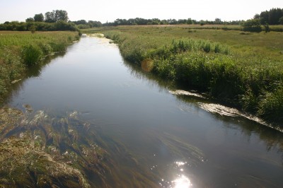
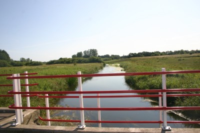
what used to be Germany into Denmark, as we cross Kongeåen. We cross on the
bridge called “Frihedsbroen” which means Freedom Bridge. The bridge is painted
in the Danish flag’s colours, namely red and white.

Between 1864 and 1920 Danes living on the “wrong” (south)
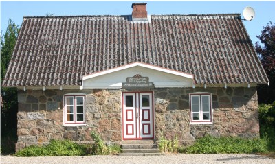
side of the border were very patriotic. One notable such person was the farmer
H.D. Kloppenborg. He built a house on the “right” (north) side of the border
and went up there on weekends where he brazenly raised the Danish flag to the
great annoyance of the German soldiers on the other side of the river. He
called his cute little stone house “Friheden” which means “freedom” and it is from
this house that the bridge got its name.

A few kilometres further north are more manifestations
of the Danes’ need to assert their language and national pride in the period
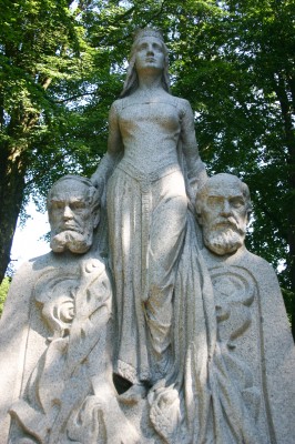
between 1864 and 1920. At a place called Skibelund Krat there are 22 memorial
stones in honour of some of the people who fought for the rights of South
Jutland. One stone is simply called “Modersmålet”, i.e. “Mother Tongue”, and
shows a woman flanked by two Danish poets looking longingly and steadfastly over
the Kongeåen river valley in the direction of the part of Denmark that Germany
acquired (but that we got back again).

History aside, our feet are getting sore and our legs
tired. Niels has blisters on his toes and my knee is not as good as it was
yesterday. Today most of the route is on asphalt, which is hard on our worn out
legs and feet. We trudge along, passing
through the town of Vejen. This is where Niels is a member of the town council,
representing the Social Democrats. That is not my party, so we often have
lively political discussions. In fact, I also lived here a few years back, when
I was breaking into journalism, so it all feels a bit homey.

A few kilometres north of Vejen we reach the church at
Læborg. Here there is a large granite stone with runes from the first half of
the first century – yet another reminder that this route has been in use for
centuries.
Another nice thing about the church at Læborg is that my car is
parked here. We hop into it and drive home to Niels’ house a few kilometres
away where his wonderful wife awaits with yummy, cool buttermilk soup and garden-fresh
black currants.


2 Girl talk and walk

Denmark Posted on 04 Jan, 2016 20:32

Many weekends later, I pick up where I left off in the
town of Rødekro. Rødekro means “Red Inn”. This is a rare example of a town
named after an inn instead of the other way around.

Anyway, this time best friend Åse is with me. Time
flies as we walk through village after village adorned with election posters.
We discuss the different parties and politicians, happily in disagreement with
each other because otherwise what would there be to discuss? How boring to agree on everything – who wants
to be in the company of clones? I am proud to say that votes are given to the
full range of political parties in Denmark by my friends and acquaintances.
It’s nice to know such a variety of people! Anyway, I digress.

The first part of the route leads us through flat
agricultural landscapes. Now that it is June the fields are a lush green. We
aim for the churches along the way because here we can always find a toilet,
fresh water, and a bench that we can sit on and rest our weary bones. Åse is an
expert walker and makes sure that we stop every hour or so to take off our
shoes and socks and cool down our feet. At the end of the day I discover what a
good idea that is. No blisters and no sore feet (well, almost not).

We pass by an Asterix-type monolith sitting on top of
a burial mound from the Bronze Age. The story goes that the stone turns in the
direction of the smell of newly-baked bread. I don’t blame it. Further on is
another big stone from around 900. This one has runes etched into it spelling
the name of Hairulfr. How wonderfully Nordic! Even back then this road,
Hærvejen, was a well-known road.

The next bit of history soothes our feet. We come to
the road’s oldest bridge, Immervad Bro, from 1786. The bridge is built in stone
but based on wood construction technique, in that the stone has been cut into
planks, some of which are four metres long. It is thought that all the pieces
come from the same block of granite. We
gratefully cool our feet in the stream while listening to the quiet babble of
the water. A nasty battle was fought here in 1422, colouring the water red with
blood.

At this point I am feeling seriously tired. Then, lo
and behold! In the middle of nowhere we happen upon a place where we can buy
quality coffee served by an Italian. Miracles never cease! Thus refreshed we
trudge onwards until we reach the traveler’s shelter (“herberg”) where there is
one big room with 36 beds. No private life here. It is still early in the
season so there are only two other guests. We have walked about 25 km and enjoy
sitting down to a bottle of wine and a dinner of canned spaghetti with meat
sauce before conking out on our beds.

Next day we get a nice and early start. More green
farmland and lots of verdant forest. The scenery just seems to get better and
better, but towards the end I am too tired to enjoy it. All I can think of is getting to our
destination, sitting down and drinking a cup of coffee.


Finally, around 25 km
later, we reach the spot where the car is parked. This place was a guesthouse
(“Stursbøl Kro”) for centuries up until the 1870’s. Now it is a folk music café
and a shelter with 32 beds for Hærvejen travelers. We enjoy a cup of coffee
before heading home, weary and footsore after almost 50 km in two days. Less
than 400 km to go!


1. First steps in Germany

Denmark Posted on 02 Jan, 2016 15:48

I park my car in the southernmost part of Denmark by
the town of Bov. This is as far south as it gets before turning into
present-day Germany. However, this was once Denmark. That was before 1864,
before one of those disastrous wars in which Denmark lost parts of itself. I walk unhindered across the unmanned border
and find myself in Germany. Such a different way to enter into a country
compared to less free or more paranoid areas of the world, where being
fingerprinted, checked and frisked by stern men wearing weapons is the order of
the day. Here, nobody even notices me.

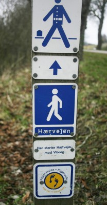
This is where the Danish section of the historic road
Hærvejen begins – or ends, depending on your approach. Hærvejen means “army
road” and denotes that this road has often been used by armies marching to wars
further south in Europe. It has also been used by merchants on their way to the
markets in cities like Hamburg and by pilgrims on their way to Jerusalem, Rome
or other places holy to them.

The ancient cobblestones are visible here. This part
of the road was the way to the city of Flensburg from the end of the 13th
century until around 1800 when it fell into disuse because other roads were
used instead.

Along the way are stone markers. They indicate who had
the responsibility for maintaining the road. Sometimes it was a farm, sometimes
a whole village, but in general, the locals helped each other with the work.

The air is chill and brisk but pleasant for walking. I
walk through the town of Bov. After a while I come to Bommerlund Plantage, a
quiet and peaceful wood. Here, the story goes, is the origin of the famous
Bommerlund snaps. In 1760, an exhausted, sick and wounded French soldier asked
to stay at the Bommerlund Inn. When it was time to leave – and pay – he had no
money. Instead, he offered the recipe for a special, fragrant aquavit flavoured
with aniseed, caraway and other herbs. This was the origin of the snaps that is
now sold as Bommerlund snaps. The old inn no longer exists but there are still
remnants of the stones that were used to fence in the cattle when they and
their owners rested at night on their long journey through Jutland. And a stone with a relief showing the travel-soldier was erected in 1960.

Further along, I pass over a lovely granite bridge
with two arches (Gejlå Bro). The present bridge is from 1818 but earlier
versions have been in place for centuries. Since Jutland is crisscrossed with
streams that empty either into the North Sea or the waters on the east coast of
Denmark, there were lots of places where it was difficult for the travelers to
ford the streams with their cattle and vehicles. Hence the need for bridges to ease the way between north and south. The road passing over the bridge is paved with cobblestones.


After passing through woods, agricultural landscapes and small towns with old churches, I arrive at the next bridge, which is Povl’s Bro. This is where I rest for the night, exhausted and footsore after 24 km on my first day.
The bridge is from 1844 and has one self-supporting arch in stone. There used
to be an inn here but I stay at a farm nearby. It is in the middle of the wood,
wonderfully quiet and pitch black at night.


On the second day my energy reserves are rather
depleted. My knees ache and my feet are killing me. Most of the route is now
past farmland. Flat and boring. It is still early in the season, so the fields
are not ploughed yet. The lark hangs high in the sky, trilling happily, and
keeps me welcome company.

The walk along Hærvejen mirrors Denmark very well. Modern
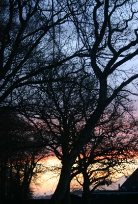
agriculture, asphalted roads, and industrial areas blend with woods, moors, old
churches and history. This is Denmark in a nutshell: old and new, cultivated
and natural.

The first stage of this crazy project has brought me
through 42 km of Southern Jutland. Just over 435 km to go!


Footsteps through time

Denmark Posted on 29 Dec, 2015 17:28


Denmark has an old road, which winds its way through
the backbone of Jutland like a crooked spine. Sometimes it is a mere gravel or
dirt path. Sometimes the road’s ancient cobblestones are still visible. Sometimes
the road almost disappears as it makes its way through a grassy meadow. Other times
it shouts its presence in the shape of a busy asphalted highway. This route has
been the life nerve of Jutland, connecting its farms, hamlets and towns with
the markets, wars and religious destinations south of the border in Germany and
beyond.

Countless merchants, farmers, soldiers, pilgrims,
adventurers, bad guys and good guys, Danes and foreigners have travelled this
route through the centuries and found hope, despair, disappointment, fear,
romance, robbery, rape, adventure, murder and enlightenment. Some have gone
home richer, some poorer, some not at all.

I also intend to follow this route. Armed with a
backpack, map, good shoes and toothbrush, I will walk from the border between
Denmark and Germany all the way up through the peninsula of Jutland until I can
smell the North Sea from the northern coast. This will take me a while, but
even the longest journey begins with one single step forward. So let’s do it! Follow
me as I walk through the landscape and history of Denmark.


Natural beauty in Jutland

Denmark Posted on 10 Jan, 2015 17:11

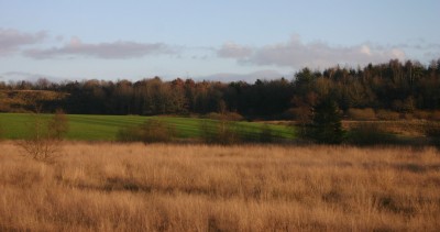
The scenery in Denmark is not spectacular. Nor is it forbidding, wild and remote. It is for the most pretty, pastoral and peaceful. But that does not mean that it is boring – on the contrary. Danish nature, while not completely natural, has a lot to offer and is generally very easily accessible. I enjoy walking in the quiet places, drinking in the clean, fresh air and letting the wind blow away the dust bunnies in my head. Sometimes I bring my camera, sometimes not. Sometimes I go with a friend, sometimes not.

In March I visited friends at their summer cottage on Kolding Fjord in Southern Jutland. We went for a pleasant walk in the woods by the water and were so busy talking we almost did not catch the sunset.

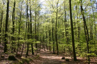
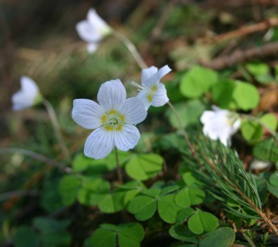
Later in the spring, in April, I headed for the beech forest by the lake Slåen Sø in central Jutland, not far from the town of Silkeborg. A beech forest is the best place to be in the spring, when the tender green leaves of the stately beech trees unfurl in a virginal light green. Tiny white flowers bloom on the forest floor, lighting it up like newly fallen snow.

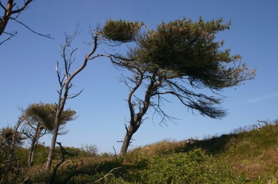
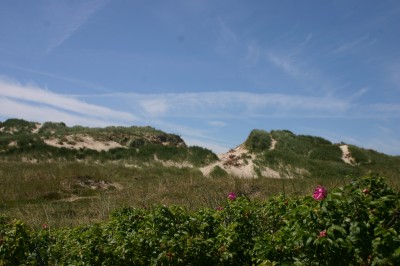
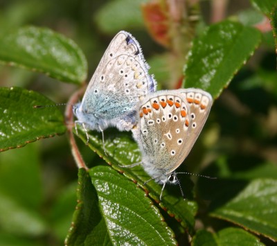
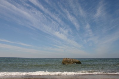
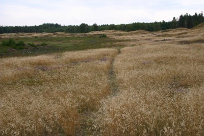
In June I took a hike along the west coast of Jutland, right by the sea. This area is usually quite windy. The trees take it in their stride, turning their backs to the wind and leaning heavily to the other side, like old people with rheumatic backs. Fragrant and health-promoting rose hips bloom merrily and provide mating grounds for butterflies. On the other side of the constantly shifting sand dunes lies the blustery North Sea, where remnants of World War 2 concrete bunkers solidly built by the occupying Germans dot the coast. The bunkers were made to last (and they do!), but the sea is making its inroads on them. Mother Nature is stronger than Man, thank goodness.


A week later I spent time all by myself in a summer cottage belonging to a work colleague. It was a totally unplugged week; no internet, no e-mail, no nothing. The weather was cold, wet and windy – just about the only week with bad weather all summer. This suited me just fine, because my intention was to concentrate on a particular writing project I am struggling with. Just outside, there were lots of wild rabbits and pheasants, and a bit futher off there were seals, so I was not at all lonesome.

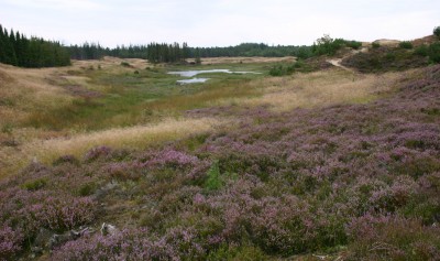
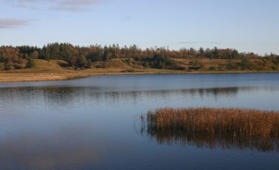
In August, I drove out to one of my favourite spots in west Jutland, namely Stråsø Plantage, and walked for an hour, enjoying the closeness and intimacy of the pine forests and the briskness of the windswept moors. At this time of year the heather is in full, purple bloom and has a heavenly fragrance. This is where I pick chantarelles, blueberries and lingonberries as well as bouquets of heather. Stråsø Plantage was the first secluded nature spot I discovered when I came to Denmark in 1979 (just over 35 years ago!) and I keep coming back again and again.

In December a friend and I walked for four hours around the lake Stubbegaard Sø, also in west Jutland. We are preparing ourselves mentally for a series of long hikes we will take next year that will stretch all the way through Denmark, from south to north. So a couple of weeks later we went for another good long walk, this time in the woods of Hoverdal Plantage, close to where my friend lives. It was wet and cold, but bracing.

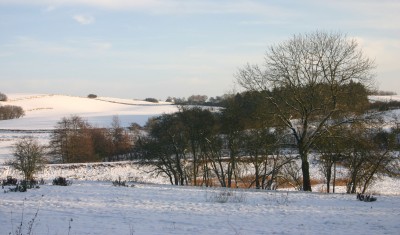
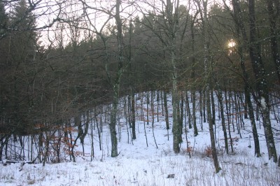
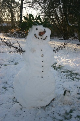
We actually had snow for one full day in Denmark, at least in Bælum in north Jutland where I was fortunate enough to be at the time, visiting friends. I spent time walking in their large, mixed wood and, together with their 9-year-old granddaughter, building a snowman in their huge garden.


Back home again and on the last day of a gloriously long (three weeks!) Christmas holiday the weather was finally perfect. So I went for a another walk. Once again, I drove out to Stråsø Plantage, this time without my camera. After walking for one and a half hours, I started to make my way home. In the last golden rays of the winter sun, before it set it in a flourish of pink, red and orange, I saw a herd of about 100 elk, peacefully browsing in the distance. What a wonderful sight – they made my day.


« PreviousNext »