Blog Image

travels with janne

2-Shades of brown and blue

Greenland Posted on 23 Jul, 2017 17:12

The
Greenland Ice Sheet is an astoundingly huge mass of ice and the second largest
ice sheet in the world (the one in Antarctica is bigger). Let me give you some
figures: It is three km deep in some places, almost 2400 km long and 1100 km
wide at its widest point. That is a lot of ice!! If it all melted, the global
seas would rise by seven metres. Despite global warming this will not happen
for many years to come.

Some of the
ice in this incredibly thick block of ice is 110.000 years old. (As an
interesting aside some years ago in Copenhagen I was allowed to touch an ice
core containing such ancient ice from Greenland taken by Denmark’s leading professor
in ice and climate Dorte Dahl-Jensen and that was a big moment for me,)

Need I say
more? The ice sheet is massive and impressive.

I go on a guided ice sheet tour.
The bus from Kangerlussuaq follows a rough gravel road that Volkswagen
constructed years ago so they could get out to the ice sheet and test drive
their vehicles on the ice. This is the only place where you can actually drive
up to the edge of the ice sheet. Thank you Volkswagen. Along the way to the ice sheet we pass turquoise meltwater lakes and spot muskoxen and caribou.

Then the ice sheet itself comes
into view. What a sight! The bus shifts to a low gear and we rumble onwards on
a road that gets worse and worse.

Finally, it is no longer a road so we disembark and follow a path strewn with rocks and boulders until we reach the ice sheet. Since 2001, the glacier streaming out from this part of the ice sheet has already retreated 300 metres.

We pick our
way carefully so we do not fall into bottomless cracks in the ice – a very real
danger.

I imagine
that this landscape is pretty similar to how to Canada and northern Europe
looked during previous ice ages. It is fascinating to think how powerful ice is
at shaping the landscape. As glaciers leading off from the ice sheet move, they
drag silt, gravel and boulders with them on their way. This is
what gives the ice its less than pristine white appearance. It is actually
quite dirty in some places. I see a meltwater stream where the water is greyish
blue. The colour is due to the silt the water contains. The silt is very, very
fine but if you drink the water it can clog your kidneys, our guide tells us.


1-Land of ice and rock

Greenland Posted on 20 Jul, 2017 20:33

At first
glance it may seem dull and monotonous, boundless and barren with ice and rock
as far as the eye can see. As this time of year, north of the Arctic Circle,
there is not even much difference between day and night. It is light all the
time.

Gradually,
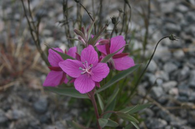
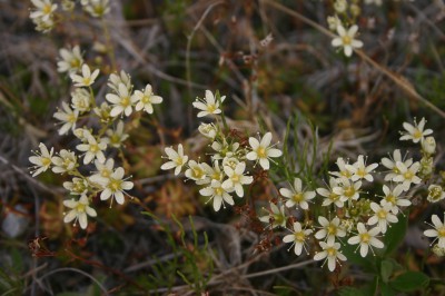
though, Greenland’s nuances peep through. You start noticing the variety of
tiny and hardy flowers that brave the harsh northern climate and eke out their
living on a meagre layer of soil. You revel in the delights of dining on seal,
muskox, caribou, whale, ammassat (capelin) and scrumptiously fresh halibut. You
discover the many shades and forms that water and ice can take. You delight in
the endless days with their ever-changing sky and varying light. And you pride
yourself on getting your tongue around the Greenlandic place names and a few of
the words.

West Greenland
grows on you. The wild and untamed nature. The friendly people. The furry dogs,
and the tasty local delicacies. Let me tell you about my adventure at the
height of the Arctic summer in this fascinating land of ice and rock.

My first
stop from Denmark is Kangerlussuaq (previously called Sønder Strømfjord). With
a population of about 500 people this town is about as unexciting as a town can
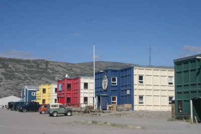
be. The houses and other buildings look like overgrown shipping containers and
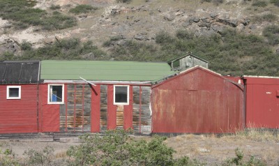
have charmless addresses like “”Block 7” or “SS-00-32”. Some buildings are difficult to discern if they are in use and for what purpose. Crumbling sidewalks
lead to nowhere. Mosquitoes abound.

Kangerlussuaq
was established in 1941 as an American Air Force base and the air force guys
certainly did not waste any efforts on prettying it up. There is a distinctly masculine
and utilitarian feel to the place. Is functional, basic and rather bleak.

Kangerlussuaq
has good and stable visibility conditions, so the airport has been central for
both military and civilian air traffic, and that is what put Kangerlussuaq on
the map to start with.

The upside
is that everything is within reach. A five-minute walk from the airport brings
me to the youth hostel that also houses a little souvenir shop. From our picnic area I can see the planes in the airport. For dining I stroll
back to the airport that has both a cafeteria (muskox stew – yum!) and a rather
pricey gourmet restaurant.

A mountain
looms up behind Kangerlussuaq, while the other side of town is bordered by a fjord
that is fed with glacial meltwater. I go for walks in all the directions I can
manage without resorting to mountain climbing and delight in the variety of
flowers and birds that for the most part are new to me. The landscape is rock,
rock and more rock. What, then,
brings tourists like me to stay in Kangerlussuaq instead of flying onwards? The
Greenland Ice Sheet is what – and this is what I will tell you about in the
next travel blog so stay tuned!


« Previous