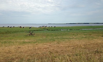
Jutland is the peninsula that sticks up from Germany
and is mainland Denmark. However, it is not all in one piece. The northern part
is actually unattached to the rest because the fjord Limfjorden cuts through
the peninsula all the way from west to east (or east to west if you prefer). 
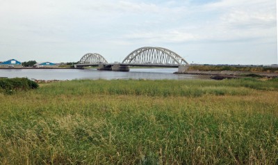
So when I cross from the main part of the mainland to
the northern part of Jutland over the bridge at Aggersund one fine June
morning, it is a milestone for me. Northern Jutland is the last leg of my
journey up through Denmark from the southern border to the northern tip! The landscape is nothing to get too excited about on
this leg of the trip, and the going on the asphalt road is hard on the feet.
This leg of the journey is just something I have to get through.
A couple of weeks later I return to North Jutland to
resume the hike. I start early in the morning, feeling fresh and perky, and
make good time. In the guide it says the next hostel is 22 km from here. Not
true! I arrive nine hours and 32 km later, totally knackered.
Tired body aside, as I expected, this is the loveliest
part of the whole hike through Denmark. Still and shady woods, and wild and
windswept heaths are punctuated by checkerboards of farmers’ fields. They are
all at their best on this warm and sunny, perfect summer weekend.  For hours, I meet not a soul. I pass by a Common
European Viper sanctuary (as quickly as possible. Yuk!). Fortunately, I do not
see any snakes, but just the thought of their presence in the vicinity makes my
skin crawl. 
Later on, I pass though summer cottage area and meet
people, many of them Germans, which is quite unhelpful when I get lost. The
signs showing the Hærvejen route seem to drop out of sight so I take a few
wrongs turns adding to the already rather long walk. I see Denmark’s only
heather-covered windmill at Grønnestrand, but am too tired to walk closer to
take a picture.


